Platform on civil engineering, underground infrastructure, energy, construction equipment & construction machinery
From point cloud to conclusion
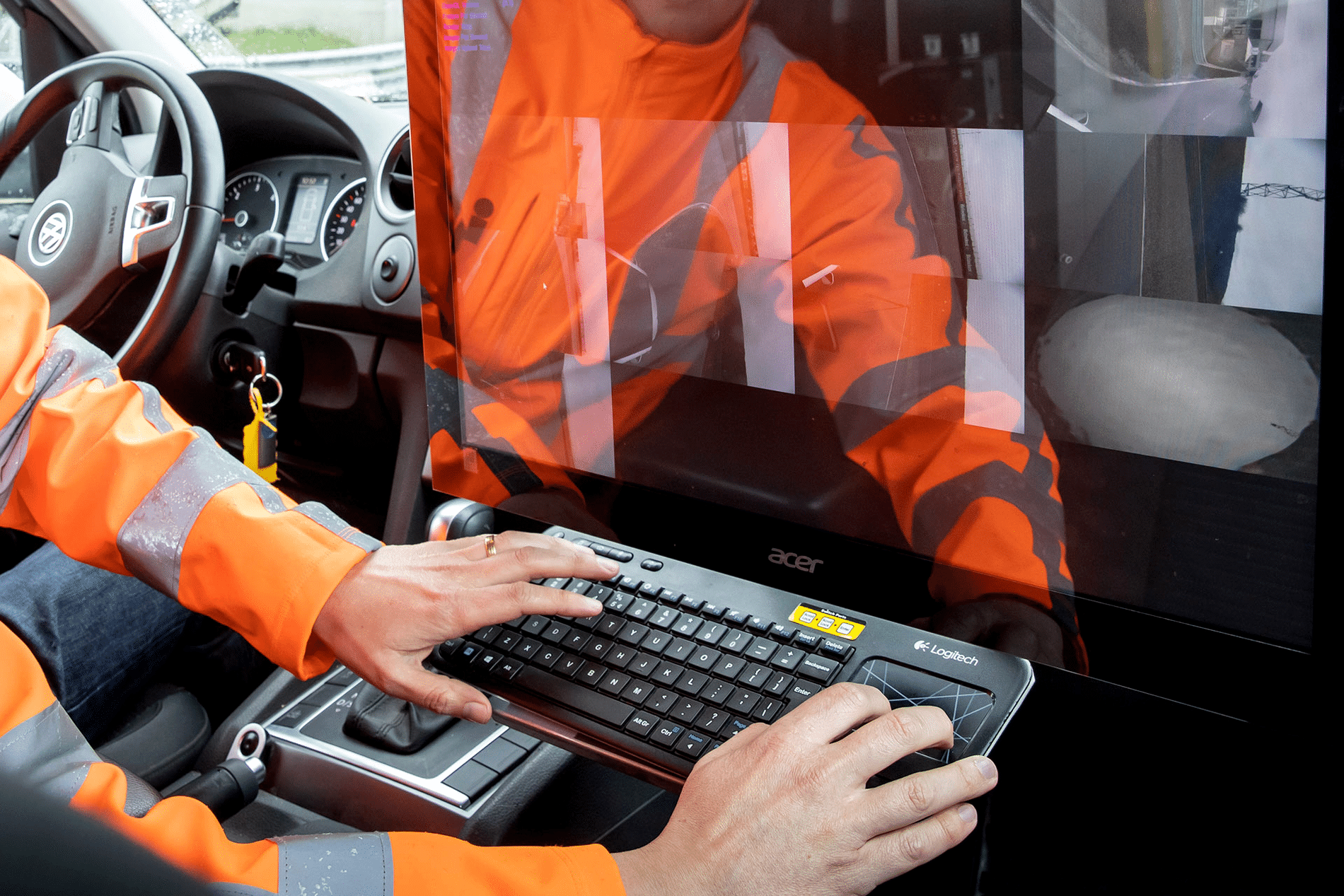
Assessing flood defenses is all about the existing situation. The relevant failure mechanisms of the barrier are assessed based on the geometry to determine whether the barrier meets the standard. In practice, flood defenses often touch directly on roads, homes and other infrastructure. This is precisely where things get complicated: how do you properly assess the situation without shutting down traffic, jeopardizing safety or taking measurements for weeks on end? Engineering firm Iv uses its own advanced scanning vehicle to fully capture the environment, driving and without disruption. The result is an accurate and complete 3D registration of the ground level, the above-ground infrastructure and all objects in the environment, which gives designers and managers instant insight and allows them to make better informed choices.
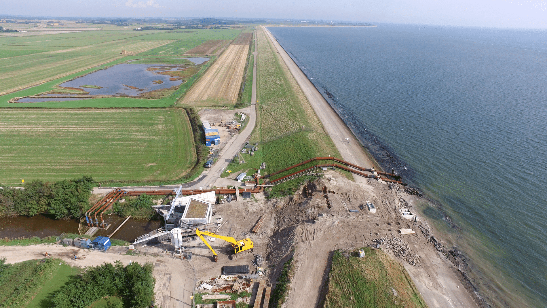
Those who think of levee reinforcement often envision heavy machinery and large amounts of soil. But the work begins earlier. Long before the shovel goes into the ground, it is all about insight: how does the dike look, how does it connect to its surroundings and where are the vulnerabilities? It is precisely in this preparatory phase that the collection of accurate environmental data plays an important role.
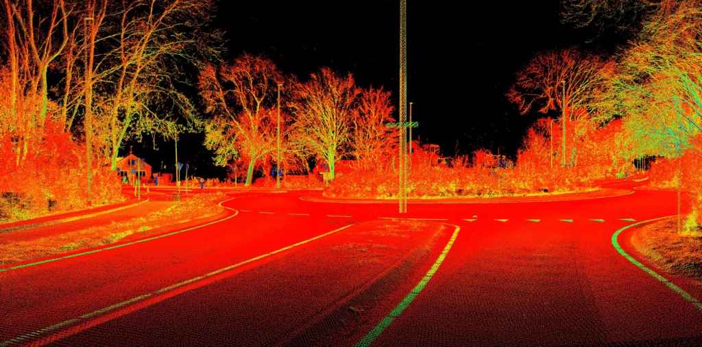
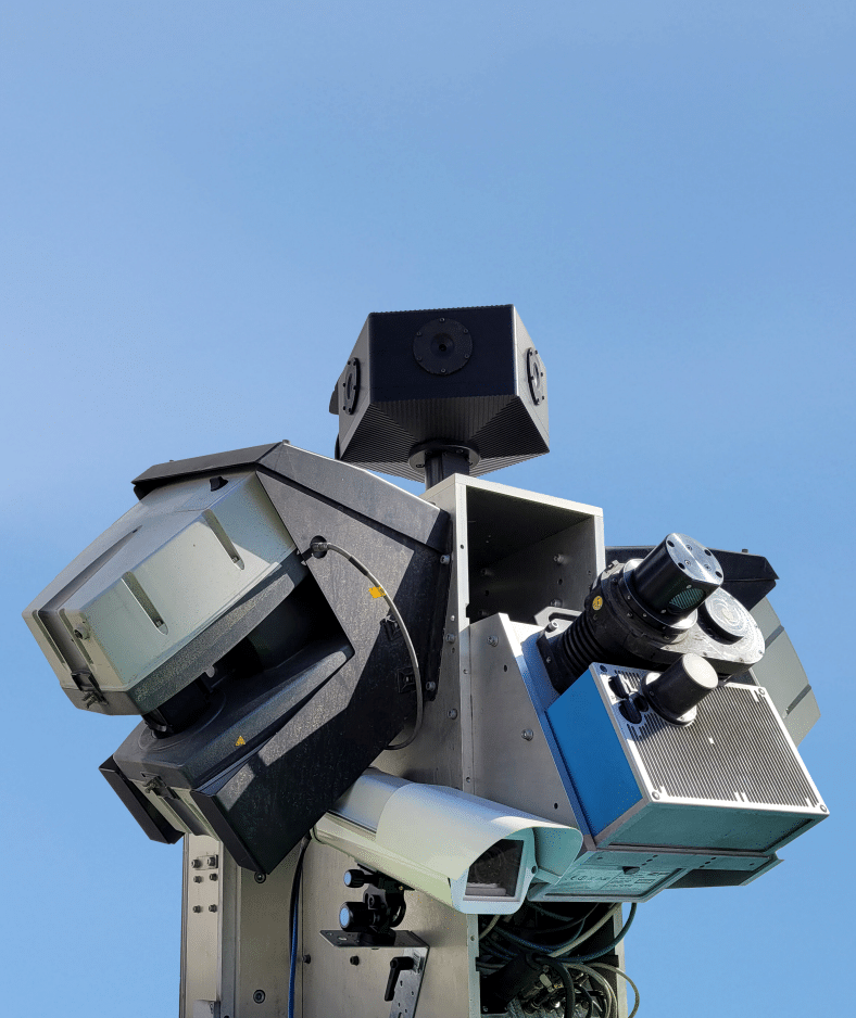
Traditionally, that information has been gathered through separate measurements, from existing maps and with additional surveys. That yields a lot of information, but not always a coherent picture. Moreover, accurately mapping the environment can be an enormously large and time-consuming task. Often, surveying the environment requires traffic measures. This is not only inconvenient for road traffic, but also increases costs. For this reason, people are increasingly looking at ways to accurately, safely and completely survey the existing situation in one go. Iv uses its self-developed 3D scan vehicle for this purpose. This vehicle is equipped with advanced 3D laser scanners and cameras that capture the environment down to the millimeter while driving. The result is a detailed point cloud, consisting of millions of laser points and a set of 360-degree images, in which the shape and size of all objects are captured. The advantage is not only in the accuracy, but especially in the completeness and versatility of the data. This means that questions that arise later in the process can often be answered by consulting the collected data from behind a computer. Re-measuring outside is then unnecessary.
Waterschap Amstel, Gooi en Vecht periodically inspects the dikes in its management area. When a dike is not high or stable enough, a dike improvement project is started. An example is the dike along the Zijdelveld, which protects the Noorder Legmeerpolder from high water from the Uithoorn polder. The question here is: does the dike meet the current standards?
The situation is complex. For there is a traffic circle that is part of the water barrier. The question is not only whether the flood barrier is adequate here, but how? Is the barrier high enough at this point? And if it is just not high enough on the current line where the dam is located, how can the existing space be used to fit the dam so that it does meet the standard? To answer these questions properly, the entire traffic circle and its immediate surroundings were recorded using Iv's 3D scan car, driving along with the traffic on a busy N-road. This is an important advantage: where manual measurement would be difficult and unsafe, the scan car can capture the entire situation safely and accurately without traffic measures. With minimal impact on traffic, this creates a complete three-dimensional image of the road, dike and surroundings.
Collecting data is not an end in itself. The value is in what is done with it. Environmental scans make it possible to compare variants more quickly, identify bottlenecks and gain a better overview of the consequences of interventions. This can also help the environment. Visualizations based on current data make plans more transparent for local residents and other stakeholders.
Joost Assendelft, Geodata team leader at Iv, was behind this first scanning car in the Netherlands years ago and is still closely involved in its further development. He explains, “The point cloud of the 3D laser scans provides accurate x, y and z coordinates of objects, making the exact location, shape and dimensions measurable. This provides a detailed and reliable overview of the infrastructure. Administrators can instantly see, for example, whether obstacles are too close to the road or thresholds and road markings meet standards, or what the exact clearance height of overpasses is.”
Instead of multiple inspections for roads, traffic signs, light poles or green space management, everything can now be captured in one measurement. “This means that all relevant data is immediately available, without the need for new fieldwork for each individual management issue. As a result, management and maintenance decisions can not only be made faster and more efficiently, but above all better aligned and better substantiated.”
By definition, levee improvements are long-term projects. Decisions made today have an impact for years. That makes it all the more important to base those decisions on reliable data. The 3D scan car is very valuable in this regard.
Currently, we have a complete picture of the existing situation together. Based on this accurate data, we are exploring the various solution directions in the combination ACW, consisting of RPS, TAUW and Iv. This has laid a solid foundation for the follow-up steps in the project, in which we are working in a focused manner to improve water safety and reduce risks to the environment.