Platform on civil engineering, underground infrastructure, energy, construction equipment & construction machinery
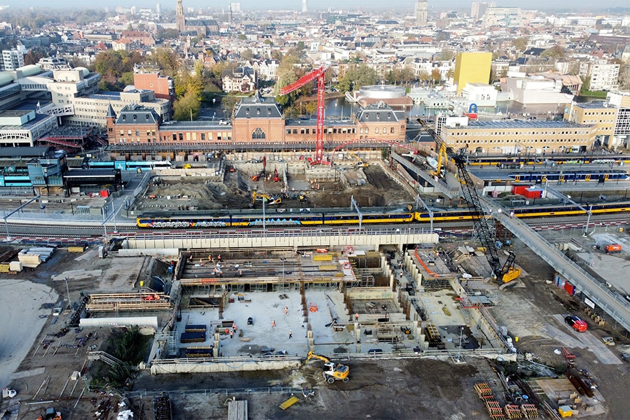
Building in a dynamic environment always presents challenges. Geocon is the link between design and realization in complex projects and knows better than anyone how to use various monitoring and positioning solutions to control projects. Geocon also has its own vision for excavation monitoring and, if necessary, uses the so-called 'observational method'. Because monitoring goes much further than just the cofferdam itself, as the monitoring specialist proved, for example, in the new railway station area in Groningen.
Geocon has been a household name in the world of monitoring and positioning solutions for over thirty years. "By construction pit monitoring we mean checking the (design) assumptions, controlling risks and ensuring safety so that the next construction phase can be carried out," begins Carlos Bosma, Geocon's business manager. "We are completely independent in our sensor selection and always look for the best solution in our approach. The measurement technology is not decisive. We first identify the risks and see what information we need to obtain to control risks or influences. Only then do we look at how we are going to obtain that information. With a camera, sensor, visual inspection or something else."
Collecting data is nice, but it has to come full circle, Bosma emphasizes. "That is, make a plan, execute it, gather data and do something with that data. That is woven into our basic approach. It requires an interaction between people, employees and technology. If those three don't work together, it doesn't deliver. There does need to be follow-up on the data collected. We use our monitoring techniques as a link between design, realization and management of a cofferdam, for example."
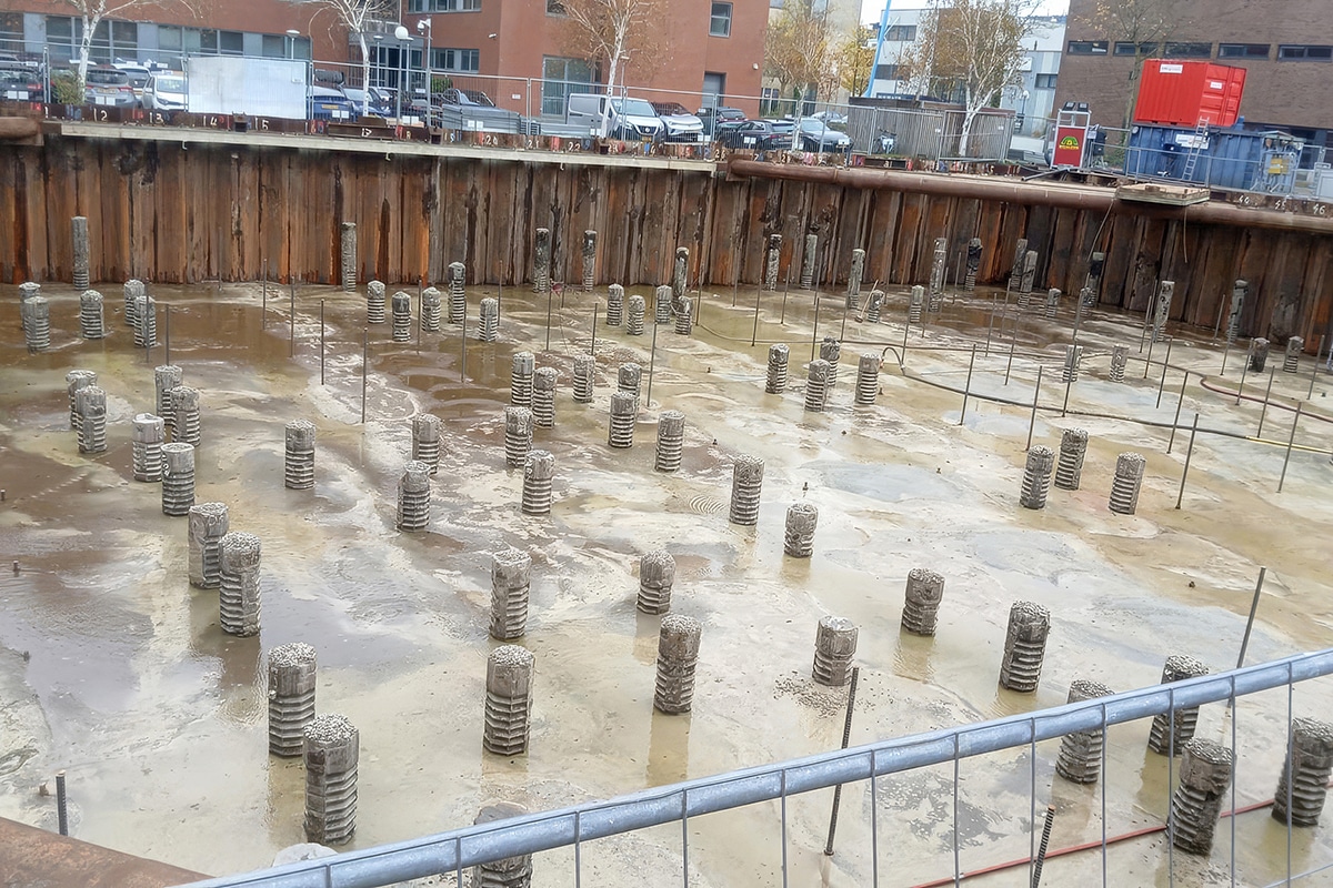
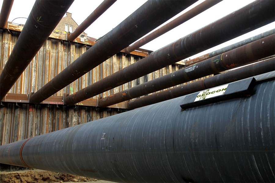
What kind of information does Geocon collect in and around a cofferdam? This includes the cofferdam itself, such as forces, deformations, inclination measurement, water level, water pressure, settlement or deformation. And don't forget the surroundings of the cofferdam: what effect does the cofferdam have on its surroundings? Consider the effect of drainage on groundwater levels and adjacent structures, vibration, noise, settlements and architectural recordings. "In Groningen, for example, we are working in the middle of the city, the railroad track in service lies across the construction pit and the 120-meter-long monumental station building is a few meters away."
In addition to a wide range of sensor and measurement techniques, Geocon also applies new technology. "For example, in recent years we have been making increasing use of satellite measurements," Bosma explains. "With these, we measure the deformation both at the landings and at street level. We use it mainly to check what the effect is on the surroundings."
What else goes on in and around a construction pit? "An important aspect is controlling all interfaces to the monitoring plan," Bosma continues. "That includes influences outside the construction pit such as groundwater dewatering with an effect on the water table. So it also means liaising with the environmental manager, the water board and municipality about permits so that they are secured in the plan. Environmental management is important for successful project management. We inventory the effects on the environment with the creation of a risk contour plan. We look at where the impact of construction extends in terms of groundwater levels, noise, vibrations, transport movements, etc. Around those risk contours, measures can be taken that are then also tested (monitored) during execution."
As a specialist in monitoring and positioning solutions, Geocon guarantees an integrated solution consisting of the best-suited technology for each issue, providing customers with reliable results.