Platform on civil engineering, underground infrastructure, energy, construction equipment & construction machinery

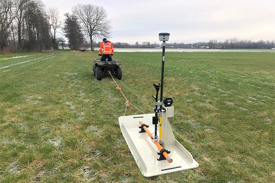
Measuring a pocket beacon manually is a time-consuming task, especially on large infrastructure projects with many dozens if not hundreds of pocket beacons. With Soilspect's Spot ONE, that's a thing of the past. The system for automatic settlement monitoring was developed in cooperation with The European Space Agency and uses advanced GNSS technology.

Soilspect was founded a few years ago by two enthusiastic techies - Hille Wichers and Daniel Spils - with the ambition to further digitize the construction and infrastructure sector. But mainly to offer companies the opportunity to get started with innovations. The Spot ONE is the first result. "The manual measurement of pocket beacons is actually out of date," Wichers believes. "It is time-consuming and also not particularly sustainable if a surveyor has to manually measure the pocket beacons. The Spot ONE makes surveying much more efficient and therefore more sustainable. Moreover, there is a real-time view of a project's progress."
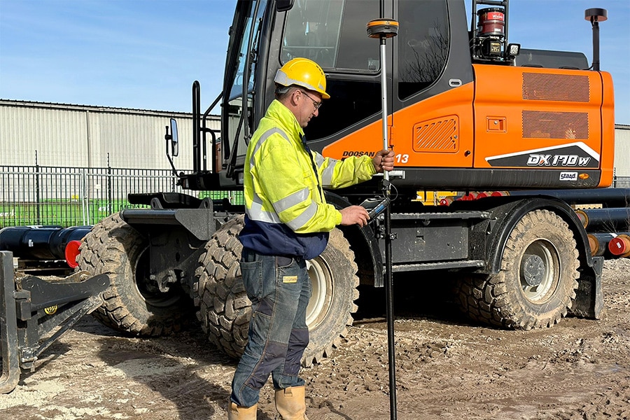
The Spot ONE is basically a measuring station placed atop a pocket beacon. "The system is activated according to a set interval, performs a measurement and transmits the data to a software portal," Spils explains. "It is also possible to load the data into the company's own geo-ICT system for further analysis." Wichers adds: "The Spot ONE is powered by a battery with, depending on the configuration, a lifetime of one and a half to three years. All the technology is 'packaged' in an extremely robust and recyclable housing that can literally take a beating. On site, it is a matter of attaching the system to the base plate of the pocket beacon and the Spot ONE starts measuring immediately. There is no on or off button on it." The Spot ONE has been extensively and successfully tested by Boskalis on the Markermeer dikes. "Even with a layer of mud on the device, the data still came through perfectly."
Thanks to advanced GNSS technology, the Spot ONE is more accurate than traditional GPS systems. "The device was developed with the help of The European Space Agency (ESA), an authority on satellite signals," Spils said. "We can also use ESA's production facility, since we are located in the ESA business incubation center, part of the Space Campus in Noordwijk. That means we can scale up quickly as demand increases." In fact, Soilspect assembles the equipment in-house, which Wichers says is mainly "rented. "We supply the hardware, software and a piece of service, so that we can completely relieve customers in the area of settlement monitoring." And that's probably not all, as the gentlemen have sky-high ambitions. "Our goal is to significantly increase efficiency in construction and infra with smart hardware and software applications." To be continued, no doubt!
About GNSS technology
GNSS satellites are indispensable tools of modern technology and are responsible for sending signals to Earth for navigation and location determination. They are part of systems such as GPS, GLONASS, Galileo, Beidou and QZSS and are located around 20,000 km above the earth. The GNSS receiver in Soilspect's Spot ONE determines its position by listening to signals from multiple GNSS satellites and measuring the time it takes for the signal to travel from the satellite to the receiver. With this information, the receiver calculates its distance from the satellites. The atmosphere can cause deviations in the calculated distance and thus cause inaccuracies in the position calculation. Using RTK (Real Time Kinematic), this signal is corrected resulting in highly accurate positioning. RTK works by using at least two GNSS receivers, with at least one of the positions known. The accurate location is determined by comparing satellite data from the two receivers. This is many times more accurate than using only one receiver. RTK correction is currently already widely used in surveying