Platform on civil engineering, underground infrastructure, energy, construction equipment & construction machinery
More than forty years ago, an ambitious idea was born in Delft: could there be a smarter way to record outdoor spaces? A camera system was developed as part of a surveying project at Delft University of Technology to record the physical world more efficiently. That innovative research project has grown into a leading Dutch company with
global operations.
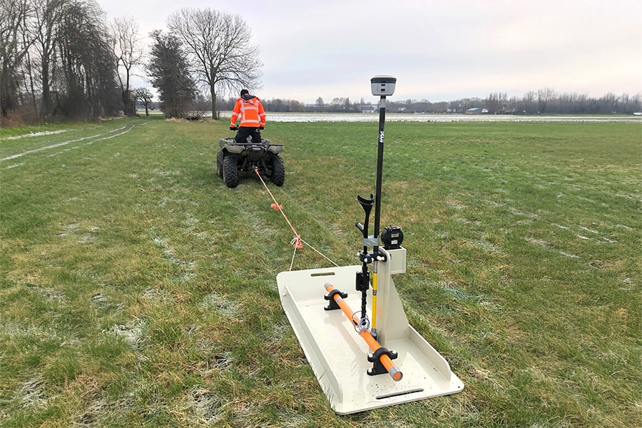
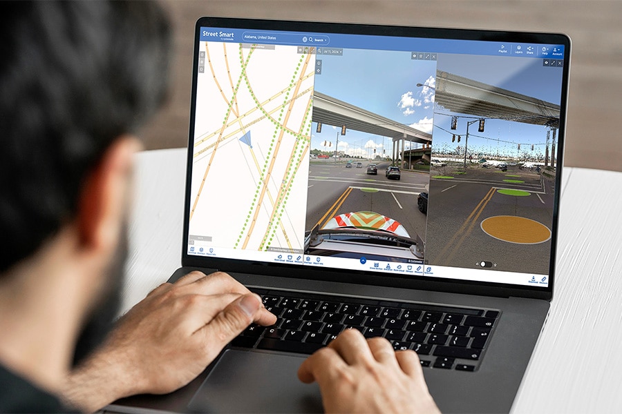
Today, Cyclomedia captures outdoor spaces with a fleet of around 100 vehicles, 15 of which are permanently on the road in the Netherlands. “Using 360-degree photos and LiDAR point clouds, public spaces are mapped in detail,” says Bart Verhoeven, marketing manager at Cyclomedia. “The collected data is made accessible via our own Street Smart tool or via APIs that integrate with our customers” software.”
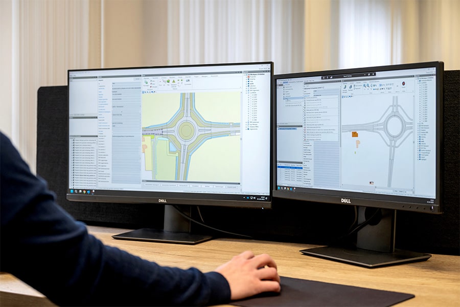
Cyclomedia is the market leader in the Netherlands. “This means that virtually all local and central government authorities have access to up-to-date, reliable data. Companies in the infrastructure, construction, telecom, and energy sectors also use this data to plan and carry out their activities in public spaces,” explains Verhoeven. In addition to street images, the company also offers aerial photographs, both orthogonal and oblique, which allow objects to be viewed from all angles. “Combining aerial and street images creates a complete picture of the outdoor space, which can be used in GIS, CAD, and design software.” Unlike general platforms such as Google Street View, Cyclomedia offers professional, measurable data with high positioning accuracy and historical coverage. This also makes it possible to analyze developments over time.
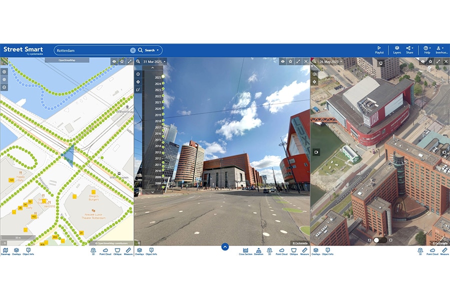
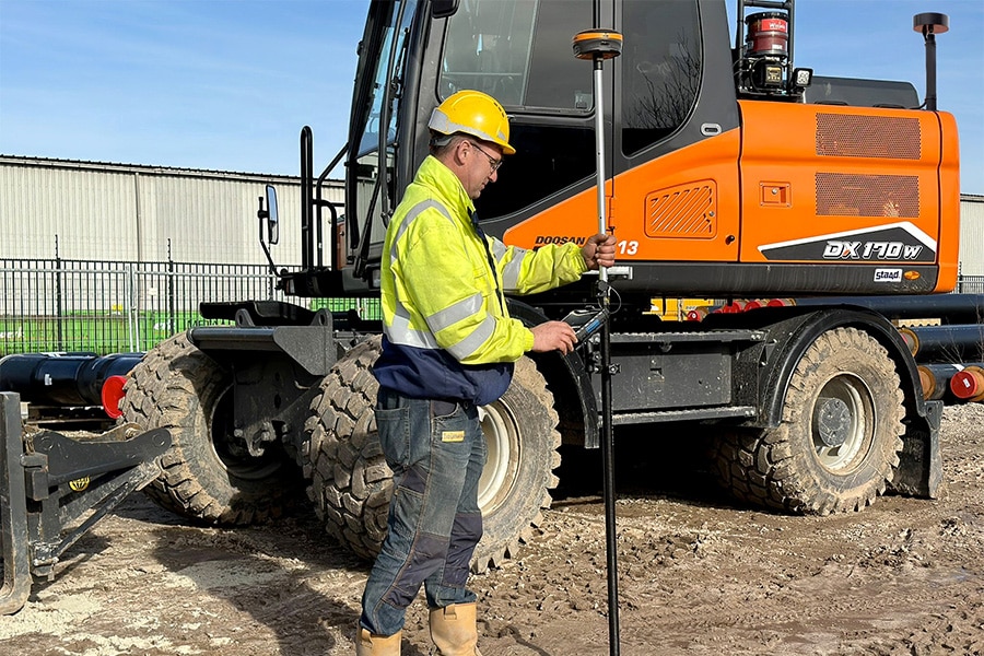
According to Verhoeven, Cyclomedia's real strength lies not only in collecting data, but in the precision and intelligence that is added to it. ‘Advanced algorithms and artificial intelligence automatically recognize objects in outdoor spaces: traffic signs, trees, lampposts, road markings, and much more.“ Assets are not only recognized, but their location, height, and even tilt are also recorded, adds Sandra Kollenburg, sales manager at Cyclomedia. ”This allows road surface inspections or asset detection to be carried out without the need for physical fieldwork. This results in greater efficiency, higher quality, and a more sustainable process. It also increases safety.“
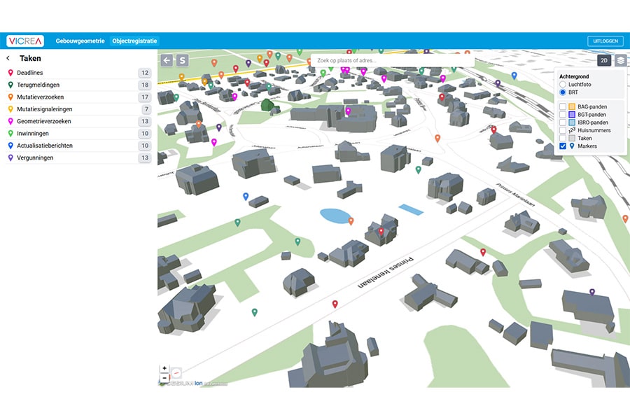
In addition to viewing and measuring collected data, Street Smart also allows users to combine data or enrich it with their own information. “For example, users can visualize KLIC reports or place 3D models of cables, pipes, and transformer stations directly in the street scene,” Kollenburg explains. “This also makes the preparation of work a lot more efficient: for example, aerial photographs can be used to determine in advance where materials and site huts will be placed and which supply routes are most suitable. Everything that normally has to be done outside can be prepared digitally for the most part. Faster, safer, and with less impact on the environment.”
Neem dan rechtstreeks contact op met Cyclomedia.
 Contact opnemen
About Cyclomedia What began in 1980 at Delft University of Technology as a project to create 360˚ spherical images from a moving vehicle has since grown into an international company that employs more than 250 people working every day to map a better world. Every year, Cyclomedia captures more than […]
Bekijk Bedrijfsprofiel