Platform on civil engineering, underground infrastructure, energy, construction equipment & construction machinery
For many years, InfraCAD CE has been the tool for surveyors, dimensioners and civil designers. To keep up with the latest technologies, ARKANCE has rewritten the application. The latest version offers even more useful functionality and a number of unique features that are even better suited to surveying and civil engineering work. In this article we zoom in on the main improvements in the modules Land Surveying, Profiles, Points and Civil Tools.

Although the old version of InfraCAD CE had been around for several years, it was still well received by the market, says Han Loermans infra consultant at ARKANCE. "Still, we saw room for improvement. On the one hand to grow in functionality, on the other hand the interface could also use an update, as it was no longer suitable for the current resolution screens. For example, 4K monitors were not supported. So we decided to rebuild the application, so that with InfraCAD CE we are again completely ready for the future."
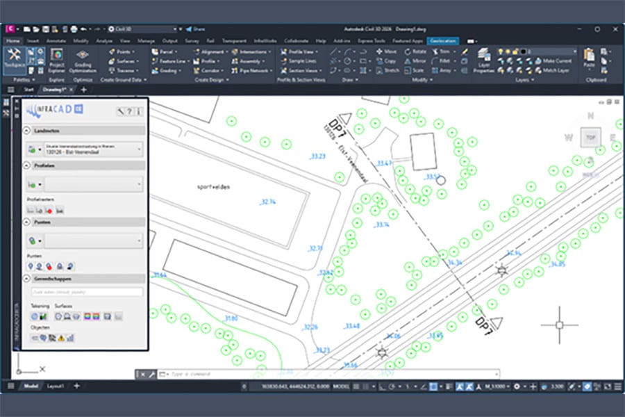
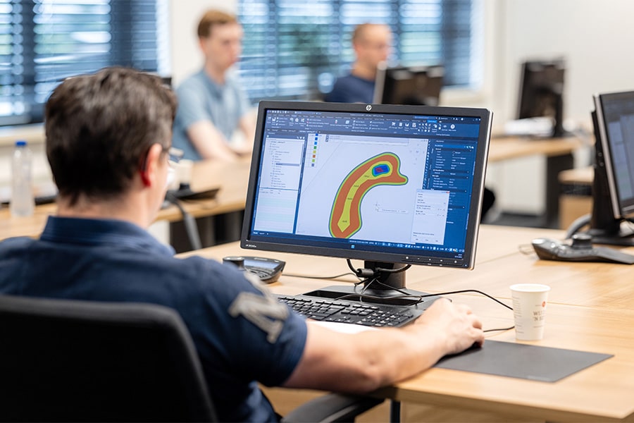
For processing surveying data, the latest InfraCAD CE offers significantly more capabilities, according to Loermans. "We have greatly improved the Land Surveying module in cooperation with the major surveying brands such as Topcon and Trimble. For example, functionality has been added to use measurement codes to get even more out of a measurement, without having to measure or use additional structures. With the extensive Measurement Code Editor, every point, line and steering code can be managed. Useful functionality is, for example, the ability to automatically place a symbol or height at each measured nodal point, or to indicate per measurement code whether it may be used to create a Civil 3D terrain model. Furthermore, it is possible to switch NLCS status during measurement, and various convenient measurement constructions such as arcs and rectangles are supported. The surveyor is completely flexible in the use of his own code library and can thus easily process situation measurements and profile measurements to AutoCAD."
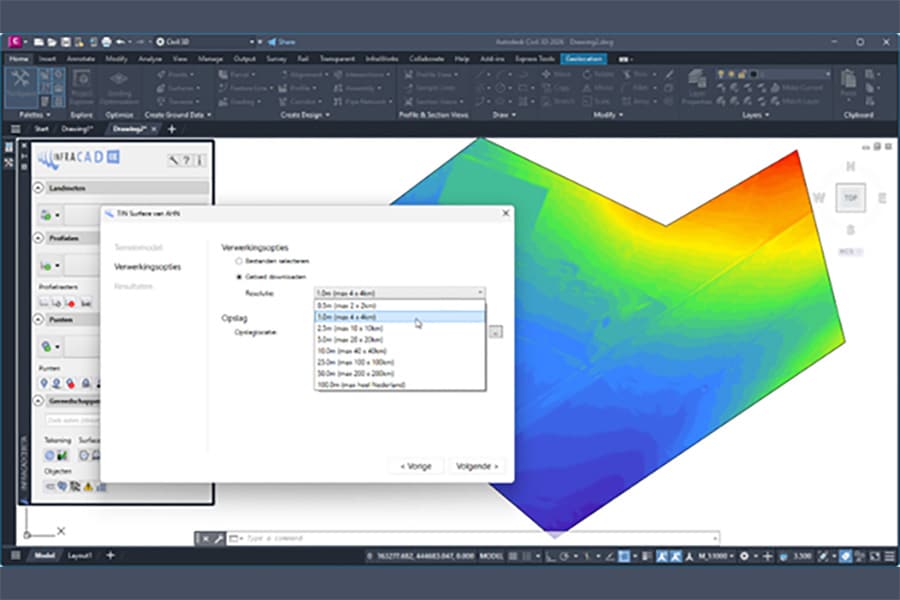
Not only surveyors, but also civil designers will be completely happy with the greatly improved Profiles module. "With a few clicks, you have a ready-to-use cross section profile of your design drawing," Loermans explains. "You draw a line and the software creates a profile based on drawing objects or from the Actueel Hoogtebestand Nederland (AHN). Objects that are recognized are automatically placed as projections. With InfraCAD within Civil 3D, it is even possible to create terrain models directly from AHN data, downloading only the desired area. That improves performance significantly, and allows you to process information faster."
The Points module can be used to create and manage point groups quickly and conveniently. A stakeout file can easily be created from these. But it can do much more, such as determining and exporting pile deviations. And anyone who regularly receives data in Excel, for example, can quickly import it into AutoCAD, as long as a location is included. Be it tree data or sewer data.
The latest version of InfraCAD CE also offers a number of handy civilian tools, Loermans says. "The address finder makes it easy to find any location in the Netherlands. 3D Polylines are offset with one click. Lines can be elevation marked, and quantities from the drawing are exported to Excel, down to the length and radius of curves. Want to add notes to the drawing? That too is very easy, as is placing a QR Code."
InfraCAD is the most widely used solution for NLCS-compliant drawing in AutoCAD, says Marco Gelens of ARKANCE. "Our clients therefore have a certain set of expectations, and rightly so. They know that we stand for quality and are proud of the software we make. That we regularly produce updates, keep up with laws and regulations and the market with ever new functionalities. And that applies not only to the latest version of InfraCAD CE, but also to Drill Control, our solution for directional drilling. We are again completely ready for the future and with InfraCAD CE we are already sorting out BIM for the infra."
Neem dan rechtstreeks contact op met Arkance Systems Netherlands.
We help you make the most of opportunities from digital transformation.
Bekijk Bedrijfsprofiel