Platform on civil engineering, underground infrastructure, energy, construction equipment & construction machinery
Underground risks are rarely visible to the general public, but they help determine whether a project runs smoothly or stalls. Many infrastructure projects in the Netherlands suffer setbacks that can also be traced back to unexpected ground conditions. Boskalis is leaving nothing to chance in the widening of the A2 motorway in Limburg and, together with Metinco, is pulling out all the stops to identify potential underground risks in advance.
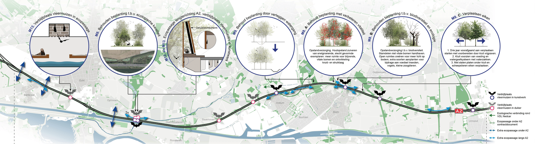
A complex part of the A2 project lies near Roosteren. “Here the freeway lies right next to the Juliana Canal, which is also higher than the surrounding ground level,” says Marco de Kleine, co-owner of Metinco. “Exactly at this spot, the Geleenbeek flows under both the highway and the canal. On a stretch of just 250 meters, road, canal, dike and stream come together. A complex node, in which above-ground interventions are only possible if the subsurface is fully understood.” For this reason, Boskalis asked Metinco to conduct an advanced geophysical survey on site.
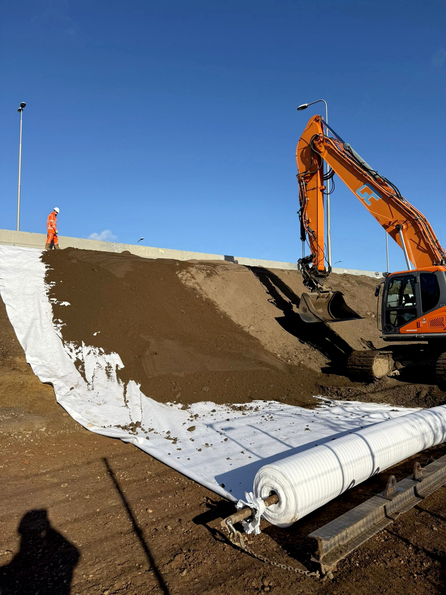
The reason for ‘minutely’ studying the subsurface at this location is twofold. “Next to the existing junction of the Geleenbeek, a new culvert is being constructed that will serve as both an ecopassage and additional water drainage,” De Kleine continues. “The floods in Valkenburg have underlined the urgency of robust water drainage in Limburg. Brooks must be able to discharge water faster towards the Meuse at peak loads. At the same time, the A2 and the Juliana Canal form barriers for fauna. The new corridor must combine both functions.”
Constructing a culvert under a canal that is higher than ground level and where ships sail daily is technically extremely complex. “The canal cannot simply be blocked for this project and the stability of the quays must not be compromised,” De Kleine emphasizes. “Moreover, under the canal there is an erratic subsoil with gravel deposits, which could cause major leaks during construction. Moreover, working in gravel can be executionally complex. Classic ground surveys such as drilling and probing provide point information, and that is not always sufficient in a zone with a complex soil structure. What is located a few meters away from a drilling or probing remains uncertain. And it is precisely this uncertainty that poses a risk.”
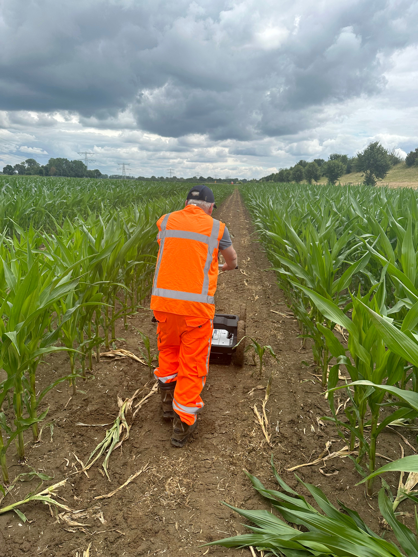
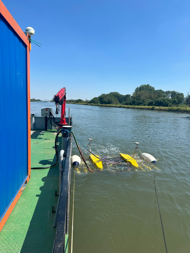
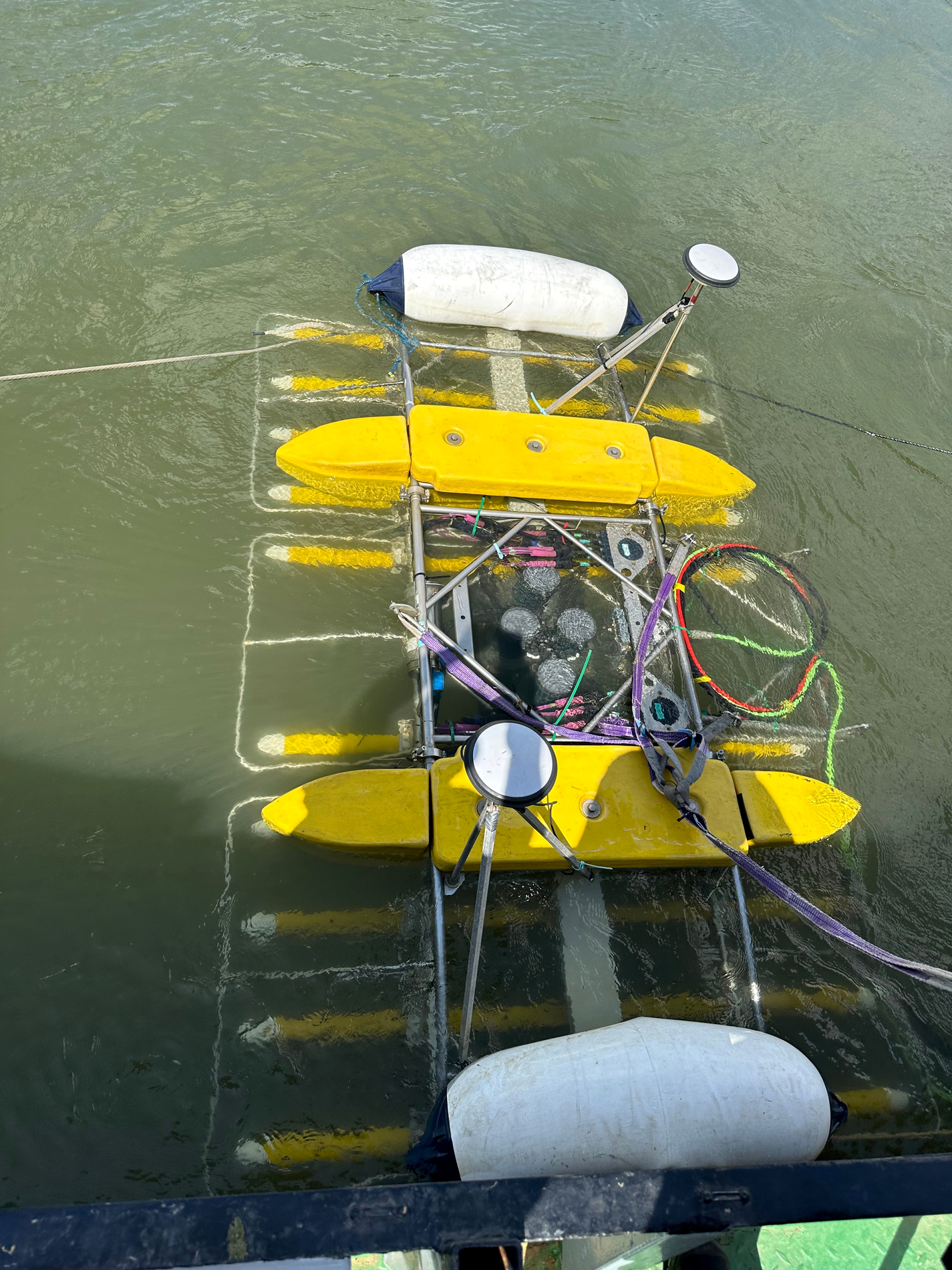
The variation in the subsurface limits the representativeness of classical research methods, such as drilling and probing, as the only source of information. Therefore, intensive use of geophysical techniques was chosen here. “Compliments in that respect to Boskalis, because in the Netherlands we are generally a bit conservative with soil research,” De Kleine knows from experience. “Traditional methods are often chosen, and that is by no means always what is possible. On this project we even used 3D seismic, an approach that is rarely used in the Netherlands in practice in our sector.”
Instead of just measuring at points, Metinco is able to visualize volumes through this broad use of geophysical techniques. “By measuring physical properties of the subsurface, such as electrical conductivity, vibration behavior and radar wave propagation, continuous 2D and even 3D profiles are created. Hard layers respond differently to vibrations than soft ones; wet or salty soil conducts differently than dry soil. Translating these physical signals into geological interpretations provides a much more detailed picture of variation in subsurface structure,” says Mike van der Werf, co-owner of Metinco.
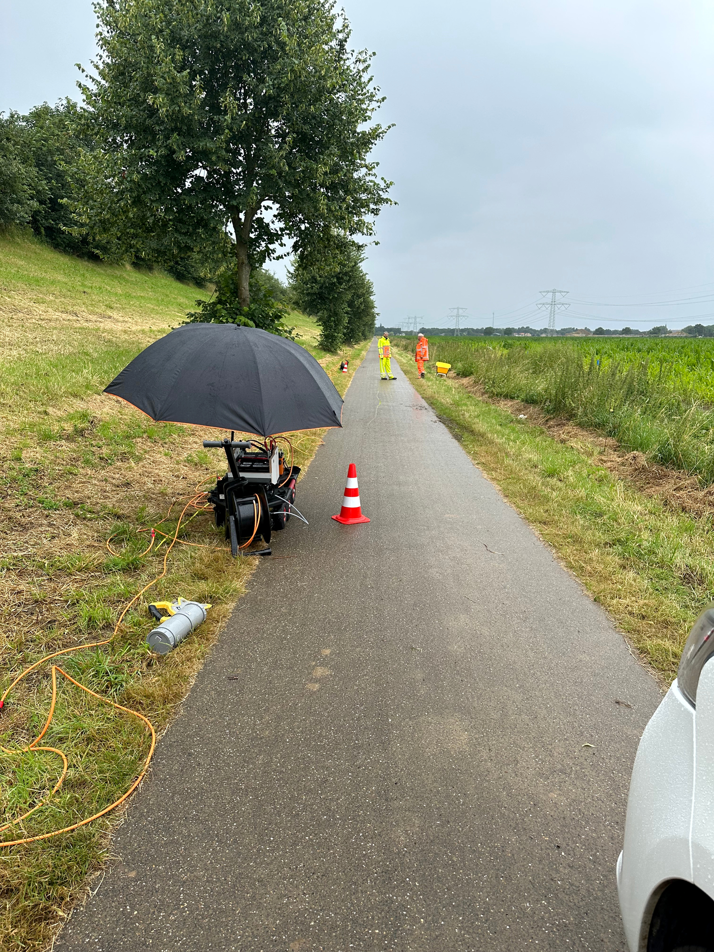
According to De Kleine, mapping the subsurface is an iterative process of measuring, modeling, designing and retesting with additional drilling in collaboration with the Department of Public Works and Boskalis. Translating geophysical measurements into geotechnical parameters or information is challenging. We often measure physical parameters other than those needed for design. Ensuring that our data becomes useful information is one of the biggest challenges. This can only be done in good cooperation between the parties involved. Otherwise, it is like speaking two completely different languages without an interpreter nearby.
In this way, different implementation scenarios are tested and risky options can be excluded or identified early.” The result is not absolute certainty. “That never exists underground, but it does provide a more informed consideration. Because anyone who wants to build safely must first understand what is happening under their feet.”