Platform on civil engineering, underground infrastructure, energy, construction equipment & construction machinery
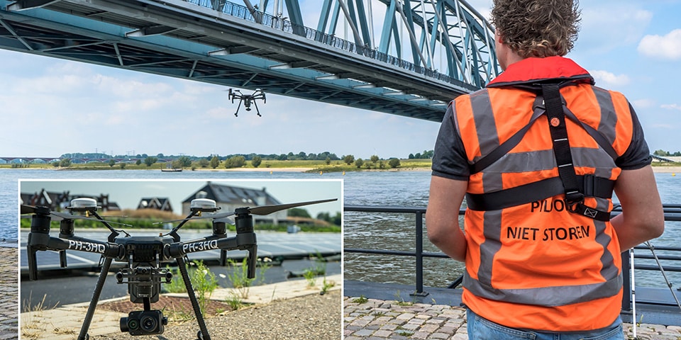
Are you a manager of bridges, chimneys, electricity pylons, levees and the like? Then you know how difficult and labor-intensive it is to regularly check their technical status. Until you call GeoZICHT's drones to the rescue. They will make your assets transparent in no time.
Insight into the technical condition, quick certainty about possible defects and that with minimal downtime and without disruption or danger to your own personnel or, for example, road users. That is what GeoZICHT can offer you in terms of visual inspection. But much more is possible: thermographic inspection, for example, where infrared images show temperature differences at industrial installations, solar parks, buildings and so on. Differences that may indicate defects or (heat) leaks. Or take 3D modeling. Here, advanced software converts the images captured by the drone into 3D point clouds and BIM models as a basis for all kinds of calculations. And before you know it, 2D/3D geodata also comes in handy. Using the highly detailed terrain information, it is easy to take volume measurements from the air, useful for quantity calculations at landfills, recording baseline situations and project progress.
For governments and (semi)public organizations, working with drones offers increasing added value. Inspections from the air have the direct advantage of a faster and more complete insight into the situation and greater demonstrability of the inspection moments and their results. In addition, there is much less traffic disruption when there is no need to close lanes. The fact that working with drones has undeniably proven to be a lot safer is also noted by the Department of Public Works, ProRail and Water Boards.
Flying drones is a profession and therefore a license is required for business use. GeoZICHT has the RPAS Operator Certificate (ROC 60/2018) granted by the Inspectorate for the Environment & Transport. In addition, pilot Bob van der Meij can use some special exemptions, due to the sometimes very specific drone assignments for (semi) governmental organizations and the like.