Platform on civil engineering, underground infrastructure, energy, construction equipment & construction machinery

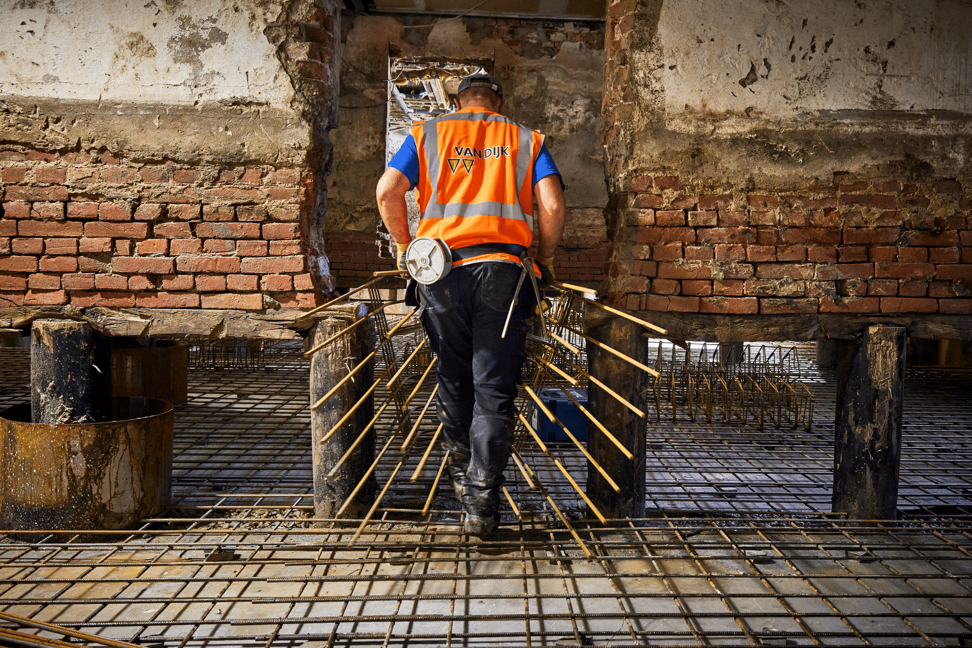
Almost all new and ongoing projects at construction company BAM can be found in the GeoPortal. By using the portal, employees and clients have real-time insight into projects. According to Jeroen Lieverdink, GIS consultant at BAM Infraconsult, the broad deployment of ArcGIS on projects leads to standardization and better project management. "As a result, we are increasingly presenting ourselves as a solutions provider rather than a consultancy provider."
Royal BAM Group nv designs, builds and maintains high-quality sustainable buildings, housing and infrastructure for clients in the public and private sectors. BAM has set science-based goals (science-based targets) to reduce the carbon footprint of its own operations by 50% in 2030 compared to 2015. "The GeoPortal also contributes to this to some extent. Efficiency in executing assignments is increased because much more information is available prior to and during work. This saves a lot of miles and therefore emissions, because there is less driving back and forth to project sites to collect data," Jeroen said.

Important is setting up the digital environment properly. "Indeed," says Jeroen. "To that end, as BAM we have a hybrid GIS architecture consisting of an ArcGIS Enterprise in the DMZ, ArcGIS Online and FME Server as a scheduled-tasks server. The technical and functional management is in the hands of Team GIS, of which I am a member. This ensures optimal communication with BAM ICT and adequate support in case of malfunctions. In addition, a basic principle is that data that requires 24/7 availability is made available from ArcGIS Online and data where 5×8 availability is sufficient is made available from Enterprise."
According to Jeroen, each project was previously provided with a partially similar customization environment. "But this caused functionalities per project to diverge. Thus, not every project could benefit from valuable tools already developed in other projects. Partly because of this, the costs per project also differed. Both were undesirable according to those responsible in the business. Thus the concept and development to provide each project with a functionally rich, equivalent, quickly deliverable and cost appropriate GIS environment in the form of a GeoPortal with information products was born. This in line with the existing user processes. With the premise that data and functionalities are always, everywhere and on every device available. Both internally and externally. We have thus ensured that we can easily serve many projects in a standard way by automating the ordering process for the GeoPortal. In addition, we have and see further development, in terms of integration with other information systems, such as Relatics (Inspections), Maximo (Asset Management) and Sharepoint (documents, photos and recordings)."

Jeroen: "Although the solutions are offered as low-threshold as possible, they are still one of many available to and in the eyes of users. And although users have been included in the development, support during commissioning is required to once again be able to establish the simplicity and value together. Both inside and on the project site. On the other hand, of course, it just has to work. And then if it doesn't work properly? Then fix it immediately. After all, you often only get one chance... To generate solutions and tackle problems on projects, we set up a scrum team. Through DevOps, we ensure better and faster application development and bring software operations together. A major advantage of the GeoPortal is that mutual cooperation between those involved in a project is easier. Less explanation is needed because everyone has access to the same information from the same sources."
The GeoPortal is meeting expectations just fine. "Users are positive," says Jeroen. "All users - from stakeholders to clients and from internal GIS users to external customers - have access to their own functionalities through the portal. In addition, there was a vision beforehand to provide advance GIS users within the BAM regions with more GIS functionalities. For example, they were trained in ArcGIS Pro. With this, they now convert and prepare data sets themselves to make them available subsequently within the GeoPortal project environment. They are also the daily point of contact and the lines to other users are short. In this way we ensure optimal support to achieve adoption of GIS. Not only users, but also the 'experts' are positive. It is nice to mention that we received the Special Achievement award in GIS (SAG) during the international Esri User Conference 2023 in San Diego. A confirmation that we are more than doing well in the field of application GIS technology."
Now that the architecture is in place and the ordering process for a GeoPortal has been set up, BAM is ready to take the next steps. Jeroen: "We are working on additional information products for environmental management, safety or inspections and surveying, for example. With additional data sets and collection of LiDAR and Realistic Scans. To subsequently make these datasets, in combination with information products and services, available to clients. But also think of Augmented Reality. It should be clear that the digital GeoPortal project environment will continue to grow functionally in value over the coming years so that, also in the years to come, users can continue to make optimal use of the value of geographic information."
Neem dan rechtstreeks contact op met Esri Netherlands.
 Contact opnemen
Who we are A map connects people, wherever they are. Thanks to the insight that maps and geographic analysis provide, it is possible to make a difference. More than 350,000 organizations worldwide work with Esri's innovative technology every day. Forward-thinking organizations are solving business problems with Location Intelligence and uncovering new opportunities. In the Netherlands [...]
Bekijk Bedrijfsprofiel