Platform on civil engineering, underground infrastructure, energy, construction equipment & construction machinery
They're busy, at the Siers Group. The company in Oldenzaal is a specialist in trenchless techniques, among other things. And at a time when energy transition is a hot topic, that means: work to do. Engineers Els Seldam and Axel Bosman talk about their work, in which Drill Control 8.0 plays an important role. "Thanks to Drill Control, our work becomes better, faster ánd more fun."
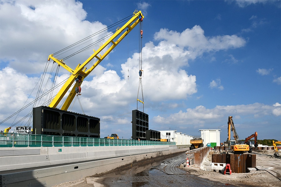
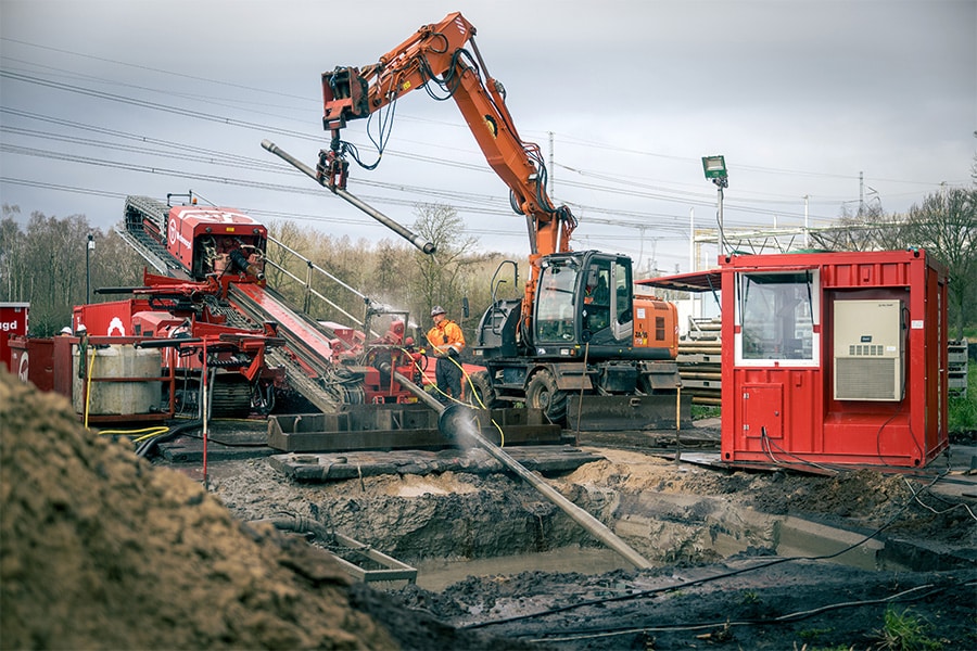
The Siers Group uses trenchless technology mainly for the installation of underground cables and pipes, such as for gas, electricity or data. "Sometimes you can't work with open trenches," Els explains. "For example, if you cross a canal, or a highway or railroad tracks. Then you switch to trenchless: you don't dig, but you create a borehole and go into the depths that way, at an appropriate distance under the aforementioned objects."
The challenge here is logical: when you go into the ground, you can't see anything. And so mapping all the obstacles above and below ground is important to come up with a good drilling design. "There's all sorts of things under the ground," Els explains. "Existing drilling, foundations, or even waste containers, like in built-up environments. We need all that information." Axel adds: "We download cadastral boundaries, for example, and the BGT, the Basic Registration of Large Scale Topography. We also request KLIC data from the Land Registry. We process all this data with InfraCAD Map. The result is an AutoCAD drawing that we use in Civil 3D as the basis for the drilling design."
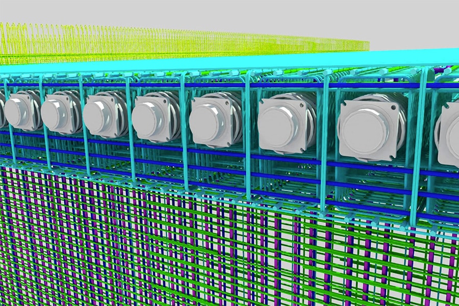
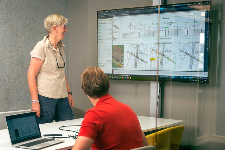
Drill Control (as a plug-in for Civil 3D) takes care of bundling all relevant information. "Such as generating a longitudinal profile," says Els. "In it you see all cables and pipes at exactly the right depth and position. That's quite a difference from before... When I became an engineer of 'trenchless techniques' in 2005, Drill Control did not yet exist. We had to draw and calculate everything manually. What used to take several days, you now do in a few hours. This makes the final generation of a drilling design a lot easier. And that, in turn, allows us to take on more jobs."
Axel shows the ground-level profile of a current project in which the Siers Group is installing three bundles of medium-voltage cables. "Parallel to the track, under a canal and also we pass a watercourse. Drill Control creates the ground level profile, allowing us to see at a glance where the intersections are and whether our drill line is nice and level. Arc radii, angles, minimum depth ... we enter our parameters and Drill Control automatically calculates it."
A step earlier, Els explains, a top view is already used to determine the ideal route. "On that you can see where there are buildings, or other circumstances you have to take into account."
About Drill Control 8.0
Drill Control is software that makes designing horizontal directional drilling easier. It saves contractors, engineering firms and pipeline operators a lot of time in the design, construction and overhaul phases. Drill Control is available in multiple languages and consists of two separate applications that work seamlessly with Civil 3D: Drill Control Design and Drill Control Construct.
Key benefits of Drill Control:
- Up to 90% faster creation and modification of a design or revision
- Exports to D-Geo Pipeline, Google Earth and GIS, among others.
- Flexible importing from all measurement devices
- Available in several languages
- Professional output
- Possibility of own presentation style
According to Els and Axel, Drill Control not only makes work faster and more enjoyable, but also more reliable. "Especially if you make changes to your design later," Axel said. "We often make test trenches, usually at the entry and exit points of the bore. If it turns out we need to move the drill line up, it's a matter of dialing it in. Drill Control automatically adjusts the dimensions and all related data. Anyway, it's just busy in the subsurface today. It is not always easy to find a good location for yet another underground pipe. Drill Control provides clarity in that."
Meanwhile, the Siers engineers are working with Drill Control 8.0, a version that Els says has several improvements over version 6.0. "An example is the automatic drawing in of the ground level, including all cables, pipes and their respective depths." Axel: "I also find the dynamic adjustment of drilling lines an advantage. Normally you would have to reconnect and check everything again, but version 8.0 creates a correct new profile itself. As a result, we can now focus even more on actually putting the puzzle together, instead of mapping and adjusting the boundary conditions."
About the Siers Group
The Siers Group (Oldenzaal, founded in 1964) provides a complete package in the field of underground infrastructure in virtually all of the Netherlands and Germany. Over 700 employees give daily substance to the slogan 'Grounded in Quality'. The Siers Group is a true family business, has a great social feeling and strong social commitment.
Back to energy transition, which is currently bringing the Siers Group many contracts. Axel nods: "Particularly medium-voltage projects, because the current networks simply cannot handle the transport of electricity. Roughly three-quarters of all projects require at least one bore. Of course this also involves equipment, but the impact on the environment is much smaller than if you were to dig a trench above ground. For example, we recently drilled underground at an elementary school - the inconvenience was minimal."
Clearly, Drill Control plays a pivotal role in the work of Els, Axel and their fellow engineers. "Whether we can imagine working without this plug-in? Imagine it, yes, but it's definitely not desirable," Axel laughs. Els adds: "Version 8.0 is definitely an improvement. However, there are still points for improvement, mostly drawing-technical things. Often the supplier of the software, in this case Arkance Systems, is dependent on third parties for this. For example, I think the Land Registry could easily include Z-dimensions in KLIC data. Then the KLIC information is even more complete. Via InfraCAD Map, we can then import it perfectly and use it for our next trenchless drilling."
About Arkance Systems
Arkance Systems is a global organization of specialists that supports organizations with their digital transformation with a complete portfolio of software, hardware, courses and services. The company is the largest Autodesk specialist in the world, with a strong focus on Construction and Infrastructure. It helps customers implement NLCS and BIM, standardize CAD environments and optimize work processes and work methodologies.
Louwers Mediagroep
Schatbeurderlaan 6
6002 ED Weert
 © 1987 - 2025 Louwers Media Group.