Platform on civil engineering, underground infrastructure, energy, construction equipment & construction machinery

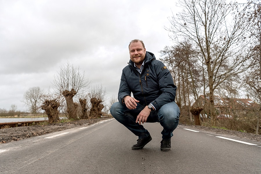
The N434 is the new east-west connection between the A44 and the A4 near Leiden. In addition to the realization of the 2.5 km long tunnel, construction consortium Comol5 is working there on a sunken position of about 1.4 km in length. We talk to Sjoukje van Heesch, landscape architect for the province of South Holland, Timo de Goede, design leader at Comol5 and Hugo Jacobs, construction manager at Comol5, about the sunken location, which has been remarkably cleverly conceived and will allow the N434 to disappear below ground level where necessary.
"The sunken location serves two purposes," Timo begins. "On the east side it bridges the difference in height between the bored tunnel and the flyover; on the west side it is purely a landscape issue."

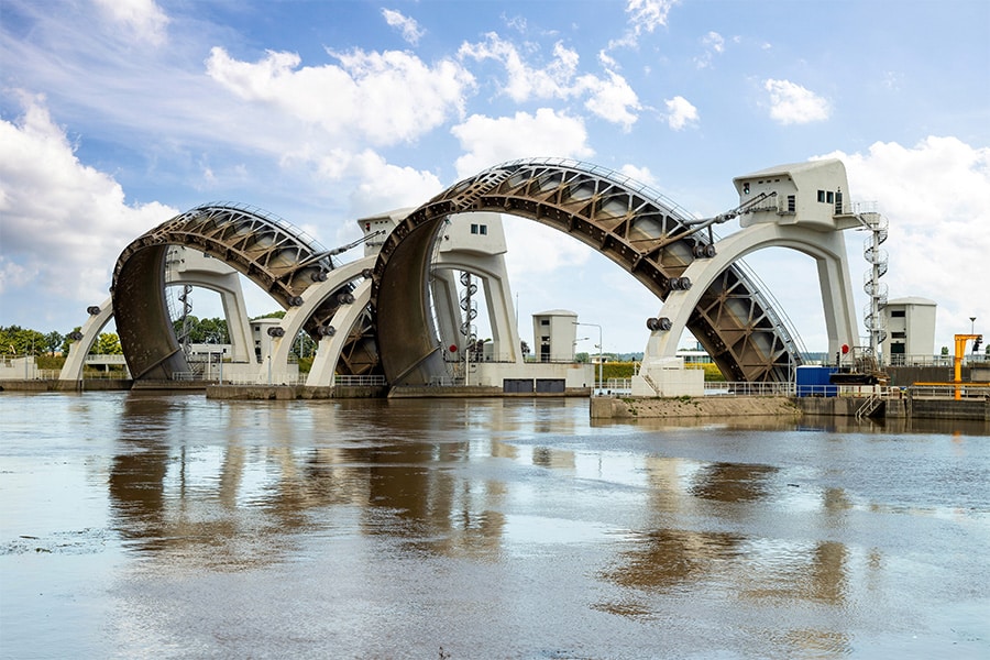
Sjoukje: "The province of South Holland has classified the polder on the west side as a protected meadow bird area and cultural-historical crown jewel. It is therefore important that the polder remains intact. It is already special that a road has been laid through it at all." In the same breath with the sunken location, the realization of the aqueduct is mentioned. "The Veenwatering runs through there," Timo outlines. "Not so deep, but wide, important for the landscape."
Sjoukje was involved in the choice for the aqueduct in 2012: "The incorporation into the sunken location is very delicate. We promised local residents that nothing would protrude above ground level. I am personally committed to that promise. Architectural firm wUrck solved this landscape-wise very nicely. Of course you have to come to a compromise here and there, there is no other way. We couldn't get around the necessary presence of a C2000 mast and a barrier. Overall, however, keeping the sunken location out of sight is very successful."

"We had a lot of consultations within Comol5, because challenges came up to the detail. With the guidelines for signs above roads, it would not have been possible to keep the signs below ground level. The solution was good and creative: we were allowed to use signs for tunnels. A smaller variant, but fully approved. That is a unique application at the sunken site."
The sunken location falls under the chapter of "construction pit technology. That means working with groundwater and thus monitoring the surroundings well. Timo explains: "The 5 to 8 meter thick topsoil is very poor. That's why the entire sunken section 'hangs' on some 6,000 anchor piles that hold the trough in place."

Hugo explains the aqueduct: "The sunken location crosses the Veenwatering, runs under it. To build the aqueduct, we first diverted the Veenwatering and used sheet pile walls. Then the first cofferdam could be built, with underwater concrete. Once completed, it could be drained to continue with the construction of the aqueduct. Floors, walls and a center pillar to support the aqueduct were realized. Below the aqueduct, in the sunken position, is a water cellar with pumping system, for rainwater drainage."
Finally, the aqueduct was put into operation and the Veenwatering was able to resume its normal path. "The detour was closed and backfilled with sand," Hugo said. "The aqueduct is 14 meters wide and 1.5 meters deep."
In terms of design, the sunken location is not only pleasant for local residents, the road user has also been considered. "Quite a challenge, especially on the west side, Ommedijk junction, the connection to the A44. In the original design, westbound motorists drove toward a meter-high pointed point. To create visual comfort, the wall along the exit towards Amsterdam in the tunnel trench has been replaced by an embankment. This automatically means that the construction pit will be wider." To this, Sjoukje adds, "This embankment was really conceived from the perspective of the road experience."
Also special are the fauna passage and the bicycle path under the A44. "These are combined with the sunken location," Timo explains in conclusion. "Quite a puzzle with the road alignment. This passage was made by means of a foil construction, so no heavy concrete container, as in the sunken position, but an open slope in a u-shape, with foil in the ground. An inviting funnel for all the fauna that want to make the crossing."
RijnlandRoute
The RijnlandRoute is a project of the province of South Holland and consists of a new road connection between Katwijk, via the A44, and the A4 near Leiden. The road solves current bottlenecks and guarantees traffic flow in the Holland Rhineland region, particularly around Leiden and Katwijk.
Two of the three RijnlandRoute projects are now under construction. The N434/A44/A4 project, which includes the bored tunnel, is being carried out by contractor combination Comol5. Comol5 is an international contractor combination of the TBI companies Mobilis and Croonwolter&dros, VINCI Construction Grands Projets and DEME Infra Marine Contractors. The N206 ir.G. Tjalmaweg project is being realized by Boskalis. The third project of the RijnlandRoute, the N206 Europaweg, is still in preparation. www.rijnlandroute.nl
Louwers Mediagroep
Schatbeurderlaan 6
6002 ED Weert