Platform on civil engineering, underground infrastructure, energy, construction equipment & construction machinery

For this year's Hessentag festival, Bad Hersfeld (state of Hesse) was expecting hundreds of thousands of visitors in just ten days - a logistical and organizational herculean task for the administration of the 30,000-resident town. To manage the influx of people, Bad Hersfeld enlisted the expertise of Topcon. Using a mobile-mapping system, a drone and advanced software, Topcon's infrastructure specialists created a digital twin of Bad Hersfeld within a few days. The city government was able to use this digital model to plan the traffic flows, emergency routes and overall logistics of the festival in great detail.
The city has extensive experience with large-scale events. Theater lovers from all over the world have been coming to the festivals of the city on the river Fulda since the 1950s. In recent years, more than 100,000 visitors visited the city's theaters during festival weeks. But compared to what now awaited the town's 30,000 residents, all previous festival experiences were dwarfed: Bad Hersfeld hosted the 10-day Hessentag 2019 last June and expected 700,000 visitors. However, 862,000 people visited the event!
The Hessentag is Germany's largest regional festival. To avoid traffic chaos in Bad Hersfeld during the festival period, the town council, with the support of Mayor Thomas Fehling, called on some clever solutions. When looking for a suitable partner, Topcon's performance and offer convinced the mayor of Bad Hersfeld: "We discussed how a small town like Bad Hersfeld could benefit from a digital twin. We soon discovered that we spoke the same language and that it was possible to build a bridge between technology, business and administration," explains Fehling. The city's "Smart City" project, which is close to his heart, focuses on the well-being of the local population: "The quality of life of citizens must improve."
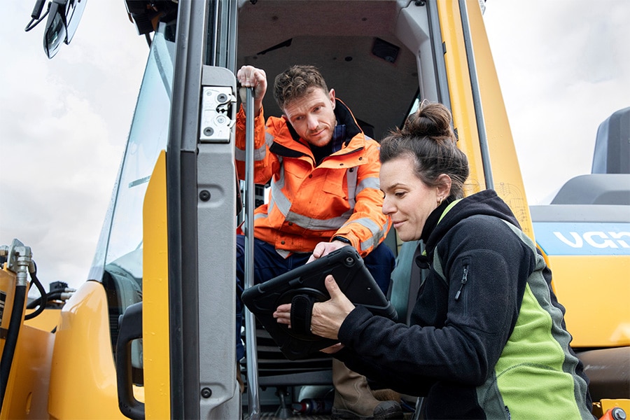
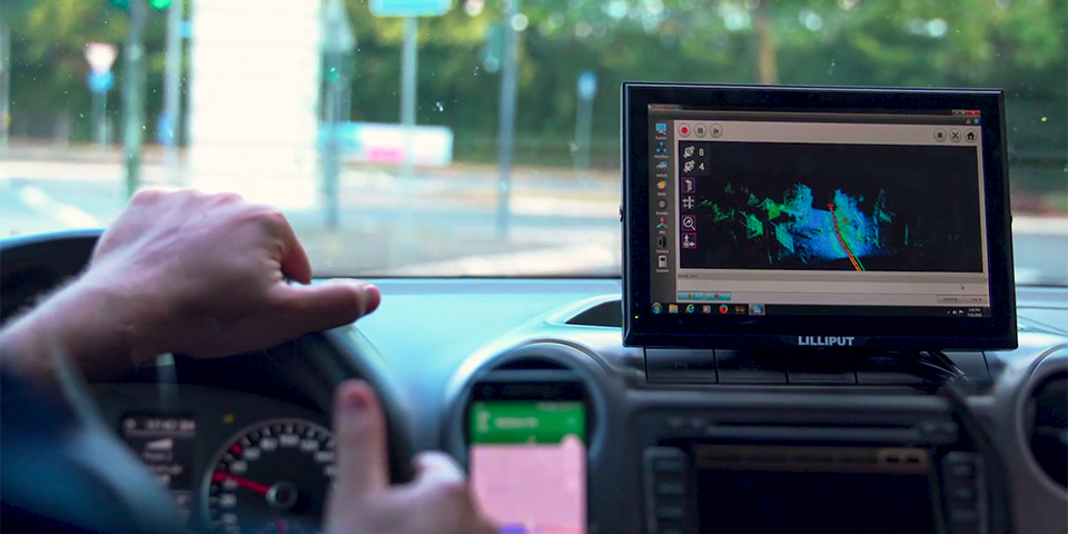
Armed with a mobile-mapping system and engaging a drone, the infrastructure experts headed to Bad Hersfeld. "We created a digital twin of the town," says Heiko Lohre, the Topcon project manager responsible for the project. Together with his team, the project manager digitally captured the city center, logistics routes, feeder roads and available parking spaces. "Our city model reproduces all the routes along which transportation and supplies for Hessentag visitors are organized," Lohre continued. In a time frame of just six hours, the technologists collected all the necessary geodata from the 130-kilometer traffic network in Bad Hersfeld and its surroundings using Topcon equipment.
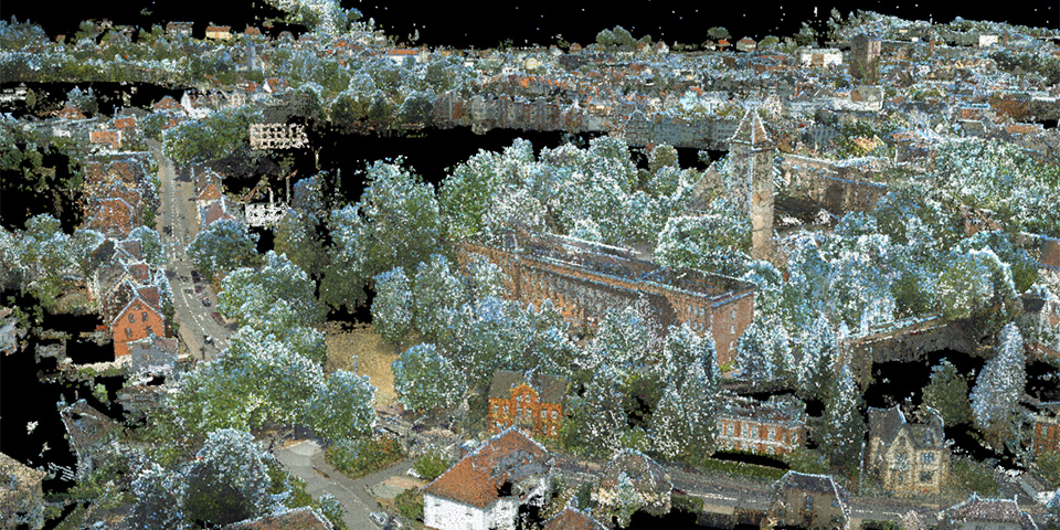
The mobile-mapping system they used, Topcon's IP-S3, consists of an odometer, an inertial measurement unit (IMU) and a GNSS receiver, which can provide highly reliable and accurate data. The mobile-mapping system is mounted on a car and records 700,000 laser measurement points per second while the vehicle is in motion.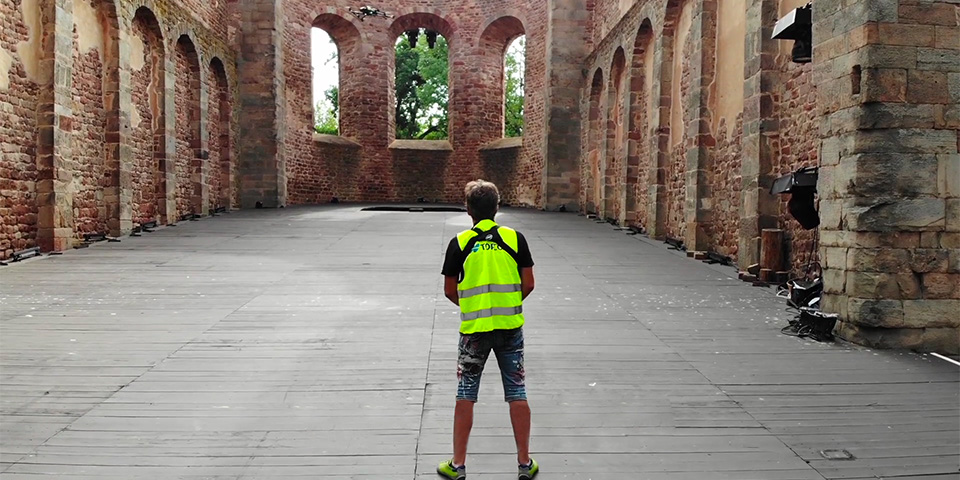
Data can be captured while the vehicle is traveling at speeds up to 80 kilometers per hour. The system "flows" unobtrusively along with daily traffic. "When the vehicle comes to a stop at a traffic light, data collection stops automatically. So no unnecessary data is collected," Lohre assures in view of data protection legislation.
Nonetheless, infrastructure experts collect huge amounts of data in a very short time. "Our mobile-mapping system records data volumes of 50 gigabytes per hour of travel," says Lohre. In the back seat of the vehicle is a PC with four hard drives, which store the captured data during the trip. The measurement team has to drive certain routes several times because even a parked truck can get in the way of correctly recording the sidewalk behind it. "We then just drive past that point again when the obstacle is gone," Lohre adds.

The final creation of the digital twins allows for about four times the time required for mobile mapping. "Essential tool for this is our infrastructure and construction software Magnet Collage," continues project manager Lohre. With a single software solution, point cloud data can be combined, visualized and analyzed at high processing speed, even if the data comes from different sources.
The mayor of Bad Hersfeld received a hard drive with the completed 3D model of his town from the Topcon team. "For this we use LAS and LAZ files - both common
exchange formats for 3D point clouds," Lohre explained. Further handling and planning-related use of the digital twin is in the hands of Bad Hersfeld itself. "Should missing points nevertheless be discovered in the model's dataset, we go back to Bad Hersfeld and correct the model with our registration and measurement systems," he assures us. He mentions another condition that the team in Bad Hersfeld had to take into account. Mayor Fehling asked the experts to ensure that the process used in Bad Hersfeld could be transferred to other municipalities and towns. "That was not a problem for us," Lohre said. The work and registration processes can be repeated in other towns at any time, he said.
When the state government of Hesse heard of the measurement project, Topcon received another assignment. While recording the city center and the relevant traffic network, the measurement team also took measurements with a drone at the ruins of Bad Hersfelder Abbey. Owned by the state of Hesse, the approximately 900-year-old ruins are not only the world's largest Romanesque church ruins, but are also the impressive backdrop for Bad Hersfeld's annual festivals. The model data captured and processed by Topcon can be used immediately to create accurate schematics of the festival's 1,400-square-meter main stage in the abbey ruins, assures Lohre.
Even at the first steps toward a successful and well-organized Hessentag, Bad Hersfeld was able to deploy its digital twin. The exact number of available parking spaces was known, as well as the areas in the city center where festival stands could be built without blocking or narrowing emergency routes. The logistics of the event were also easier to organize thanks to the digital model. Mayor Thomas Fehling is pleased with the result: "The city aims to create an efficient and sustainable transport system over the next few years. The digital model certainly provided valuable information and huge benefits," confirmed Mayor Fehling.
Topcon - Smart City from Topcon in Europe on Vimeo.
Louwers Mediagroep
Schatbeurderlaan 6
6002 ED Weert