Platform on civil engineering, underground infrastructure, energy, construction equipment & construction machinery
Borgman Beheer Advies (BBA) in Wageningen provides operational services for forest, nature and landscape management. Clients include provinces, municipalities and government agencies such as Staatsbosbeheer and Vereniging Natuurmonumenten. But private landowners also know how to find their way to Borgman. In order to work together smoothly, efficiently and in a focused way, Borgman has been using ArcGIS in various fields for about fifteen years. "Because of ArcGIS, we are able to acquire, process and make data available within complex projects in an accessible way and in real time for clients, our project leaders and our field workers," says Laurens van Egmond, GIS specialist at Borgman Beheer Advies.
Fellow GIS specialist Laura Boukje Stelwagen says Borgman uses a uniform way of working on projects. "That makes it clear for everyone involved in a project. Ranging from clients to field workers and contractors. Everyone has the same data, thanks in part to ArcGIS Pro and ArcGIS Online. This reduces potential errors, increases productivity, and we always work up to date. Paper maps are static. We provide good interactive map material that is available online anywhere and anytime and serves as the basis for a management or work plan, but can also be used when tendering for work and communicating with, for example, local residents during a project. For every project, we provide the right map tailored to your needs."
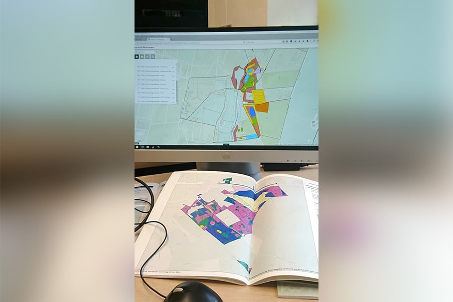
According to Gerrit Rijneveld, forest, nature and landscape management project manager at Borgman, another plus of ArcGIS is that it promotes collaboration. "Both internally and externally. Internally, for example, on larger projects, several colleagues can make and add notes in the same document, make cut-outs of maps and see project progress. Thus, all project stakeholders know where they stand and what remains to be done. It's also helpful externally that clients have real-time access to data and can monitor project progress." Laura adds: "Here you can choose the same level or just different levels of data openness. For example, certain data is only accessible to project managers. Simply because that data is not relevant for contractors, for example. Apart from this selective opening up, it is of course nice to have one dataset at your disposal. Moreover, the software is easily accessible. You don't have to be an ArcGIS expert to work with it."
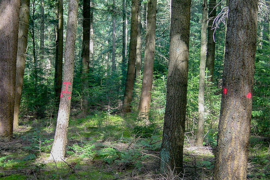
An example of a project reflecting the power of ArcGIS in collaboration is tree safety monitoring within a National Park. "Here we are dealing with different site owners. Within this project, we are mapping tree stands and gauging tree health and potential risks. In this project, field workers used ArcGIS Field Maps to monitor the condition of trees. With a phone or tablet in hand, they visualized the condition of a tree on location in the map we generated and whether possible further action was needed. Such as pruning dead branches or felling a tree if it is not healthy enough and poses a hazard. This provides an operational overview for all those involved in the project. Thanks to clear and practical reports, possible felling and pruning work can be transferred directly to the executing party. This saves time and thus costs. Moreover, this is a recurring project - trees do, after all, have a long lifespan - and the datasets are constantly being updated."
Laurens adds: "All in all, ArcGIS Field Maps in particular and ArcGIS in general is indispensable if you want to work quickly and efficiently. It saves time and data collection, analysis and implementation are easier." When it comes to projects combined with GIS, we are definitely one of the frontrunners in the Netherlands within our field of work, says Laura. "True," says Gerrit. "Looking at all our projects there is always a person from our GIS team represented. GIS is now indispensable in our services."
Thus, ArcGIS has become an integral part of Borgman's daily operations. "Indeed, we want to continually optimize and improve processes for ourselves and our clients. Add new functionalities to ArcGIS. Exploring possibilities. As a GIS team, we keep an eye on all developments in the GIS field and like to be informed about updates and new applications through various channels. The Esri community and Esri's annual conferences are also an important source of information for us, where we get inspired and connect with other GISers," says Laurens. Laura concludes, "We keep looking for practical applications that make the work even more efficient. The ArcGIS Experience Builder is a good example of that. It allows us to create our own functioning, beautiful-looking web apps that run on any mobile device and are configurable. In that sense, we never run out of learning and inspiration."
Want to learn more about how ArcGIS helps digitize your fieldwork? Check out our website or contact us.
Neem dan rechtstreeks contact op met Esri Netherlands.
 Contact opnemen
Who we are A map connects people, wherever they are. Thanks to the insight that maps and geographic analysis provide, it is possible to make a difference. More than 350,000 organizations worldwide work with Esri's innovative technology every day. Forward-thinking organizations are solving business problems with Location Intelligence and uncovering new opportunities. In the Netherlands [...]
Bekijk Bedrijfsprofiel