Platform on civil engineering, underground infrastructure, energy, construction equipment & construction machinery

A neighborhood with a village-like setting that, above all, will be climate-adaptive. BOOT was engaged from the very beginning for the surveying and civil engineering support, as well as for the complete engineering. In this, BOOT operates as a chain partner. "The project fits seamlessly with our mission and vision: working together to create a future-proof and inspiring living environment," says BOOT project manager Johan Hannewijk.
't Groene Wold comprises a 45-hectare site, half of which will soon be devoted to agriculture. Hannewijk: "The neighborhood and the plots are very spacious with lots of greenery and space for meeting and relaxation. Important themes are biodiversity and climate adaptation. The latter is expressed, among other things, in the form of
retaining and delaying stormwater runoff and employing regional and native plantings."
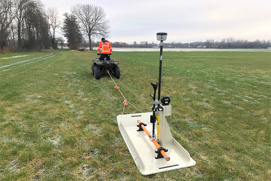
BOOT's scope on this project is extensive: "For example, we are active in conducting soil surveys and investigations of, for example, flora & fauna and explosives in the research phase. We are also closely involved in the design of the outdoor space with a focus on the water issue, sewerage, subdivision, etc.," Hannewijk explains. "Once the design is in place, we prepare the contract documents for the purpose of tendering for the construction and residential phase, and organize the tenders towards contractors. During execution, we provide management and supervision. " His colleague Arne Kooistra, GEO project leader, adds: "The nice thing about this project is that all kinds of questions come up that we can fill in surveying. There is a crucial role for data acquisition and making the design visible in the terrain. It's up to us to use the right techniques to do that. Initially, we wanted to perform height measurements with a drone, but we had to deal with the necessary restrictions because of the A27 that borders the plan at the rear. Eventually the 'open data' from the Actueel Hoogtebestand Nederland (AHN3) combined with control measurements also brought us the desired result."

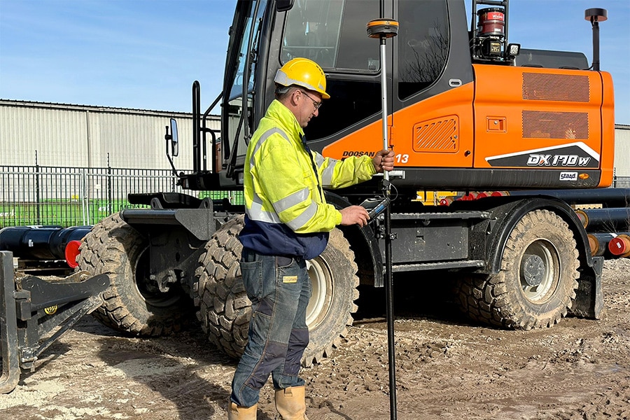
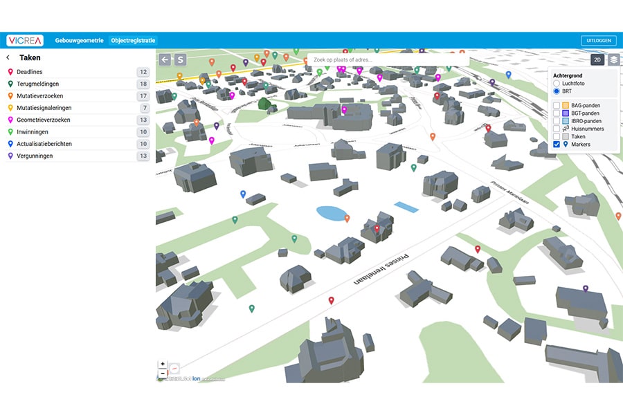
Following the height measurements, BOOT mapped the plan boundaries. In addition, relevant obstacles were measured and processed into a drawing using the Large-Scale Topography Registration (BGT) and cadastral map as a substrate. At crucial locations, the precise cadastral boundary was drawn using field work. "It resulted in a map that serves as a basis for all parties on which to fit the design," Kooistra says. "In addition, we provide surveying support for our superintendent and supervisors. For example, we review the work performed by subcontractors, provide monitoring of pocket beacons and deploy our surveying expertise in the formation of 400 plots. This process, which consists of measuring and plotting work, processing, making cadastral fieldwork and delivery to the Land Registry, is carried out from A to Z in accordance with the Land Registry protocol. We are also responsible for the building measurements of the 400 homes based on fixed points. These are just a few of the many disciplines. In short, 't Groene Wold is rightfully an integral project for us in which we deploy our expertise and our surveying services to the full extent."